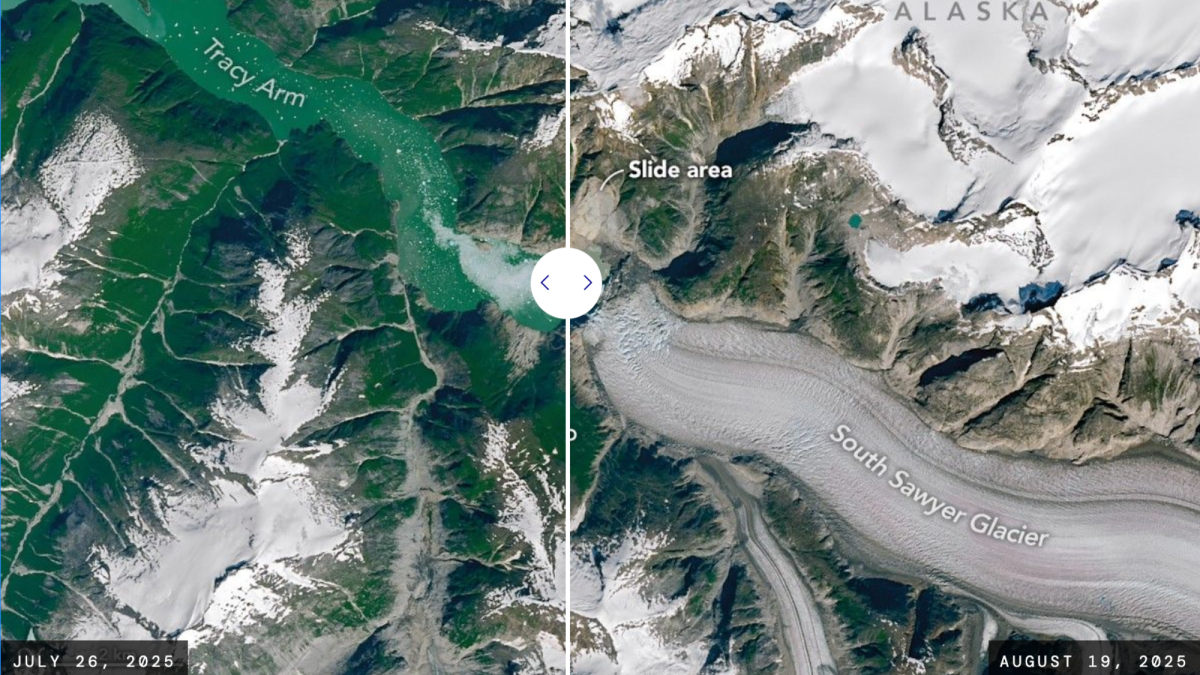
The shores of Tracy Arm, a fjord in southeast Alaska, are stripped of vegetation following a landslide and tsunami that occurred on August 10, 2025. The OLI (Operational Land Imager) on Landsat 8 and Landsat 9 show the area in the weeks before and after the event, respectively. NASA Earth Observatory images by Michala Garrison, using Landsat data from the U.S. Geological Survey Get the Popular Science daily newsletter💡 Breakthroughs, discoveries, and DIY tips sent six days a week. New satellite images are helping scientists understand a major tsunami that changed the landscape of a popular tourist destination in Alaska forever. On August 10, 2025, a tsunami larger than the Eiffel Tower ripped through Tracy Arm fjord in southeast Alaska. The rapid retreat of the South Sawyer Glacier triggered a landslide that swept huge rocks down the picturesque waterway visited by millions aboard Alaskan cruises every summer. At least 64 million cubic meters of rock slid down the slope of the glacier.…