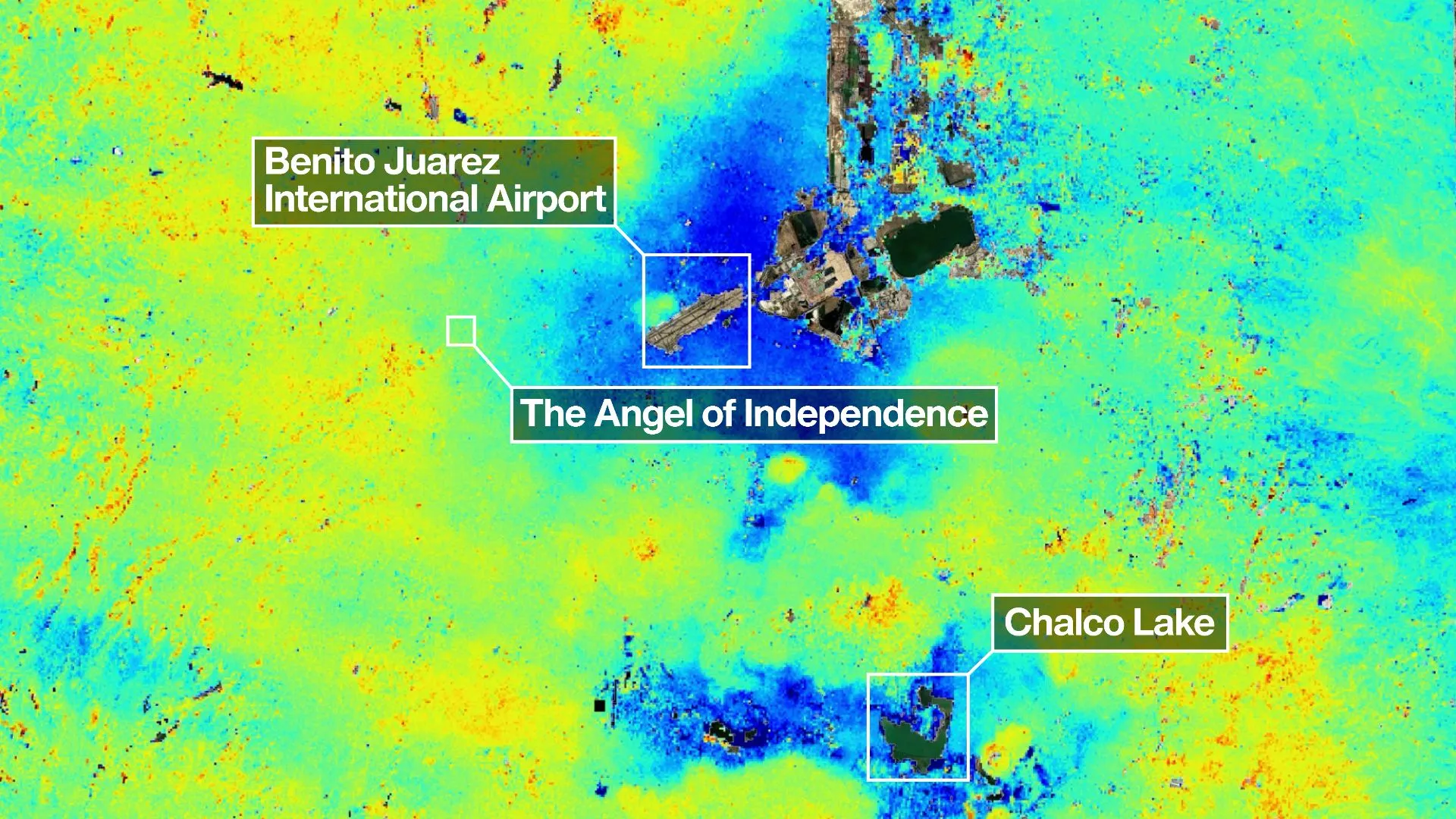
NISAR's radar image of Mexico City, showing subsiding areas in blue. (Image credit: NASA/JPL–Caltech/David Bekaert) Mexico City is sinking, and a powerful new orbiting satellite that's monitoring changes in land levels all across the globe has discovered how quickly this is happening. It's all thanks to the mission's innovative dual-frequency band radar. NISAR, the NASA–ISRO Synthetic Aperture Radar satellite, launched on July 30, 2025 as a joint partnership between NASA and the Indian Space Research Organisation (ISRO). Its mission is to track in real-time surface changes on Earth, from ground subsidence and the retreat of glaciers to and the movement of tectonic plates and the spread of wildfires — all to a precision of within a centimeter. It has been known since 1925 that much of the city, home to 20 million people, is sinking at a rate of up to 14 inches (35 centimeters) per year.…