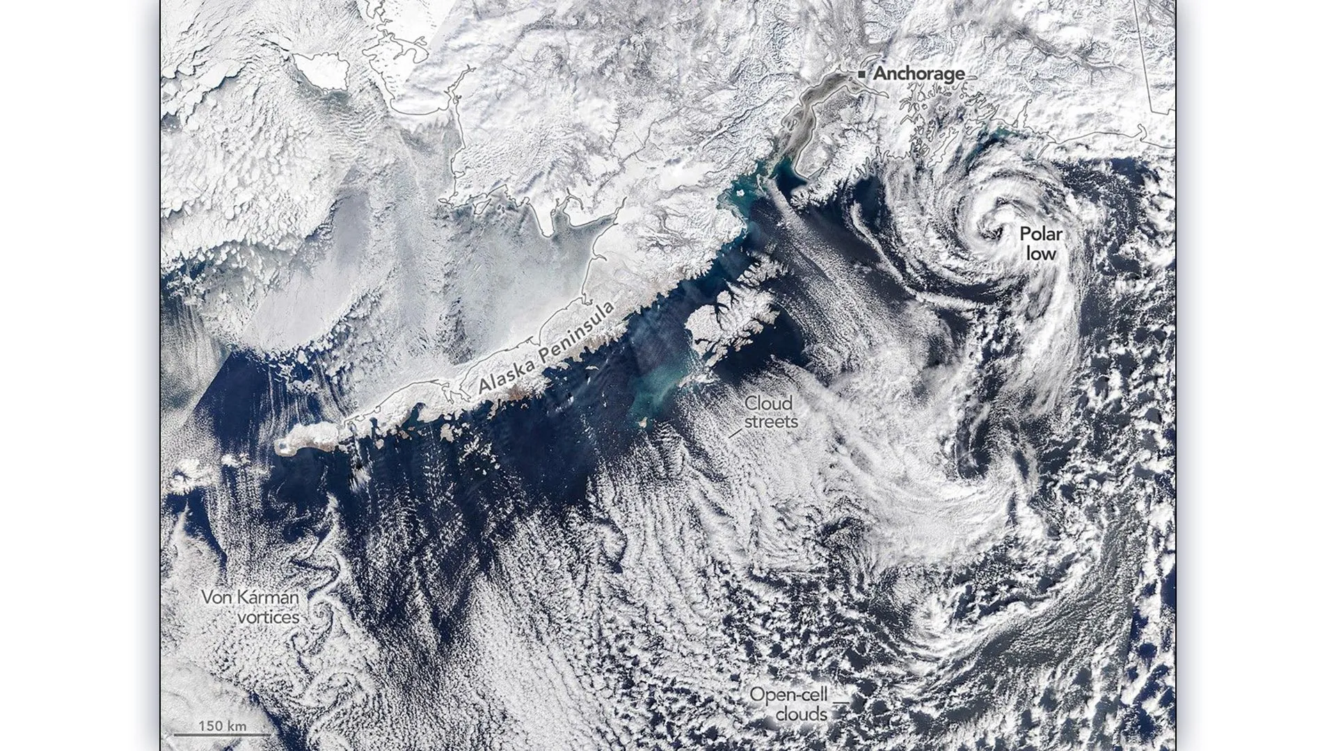
Winter 2026 ended on a dramatic note across southern Alaska. Coastal areas experienced colder-than-average temperatures along with periods of moderate to heavy snowfall. From above, the atmosphere revealed just how unstable conditions had become, with striking cloud formations spreading over the nearby ocean. On March 19, 2026, the final day of astronomical winter, a NASA satellite captured a remarkable image of the scene. An NOAA weather briefing explained the setup: low pressure over the Gulf of Alaska combined with high pressure across eastern Russia and northern Alaska. This pattern pushed frigid Arctic air southeastward across the Alaska Peninsula. How Cloud Streets Form Over the Ocean As this cold, dry air flowed over the relatively warmer waters of the gulf, it began to transform. The result was the formation of "cloud streets," long, parallel bands of clouds aligned with the wind. These features develop when the air picks up heat and moisture from the ocean surface.…