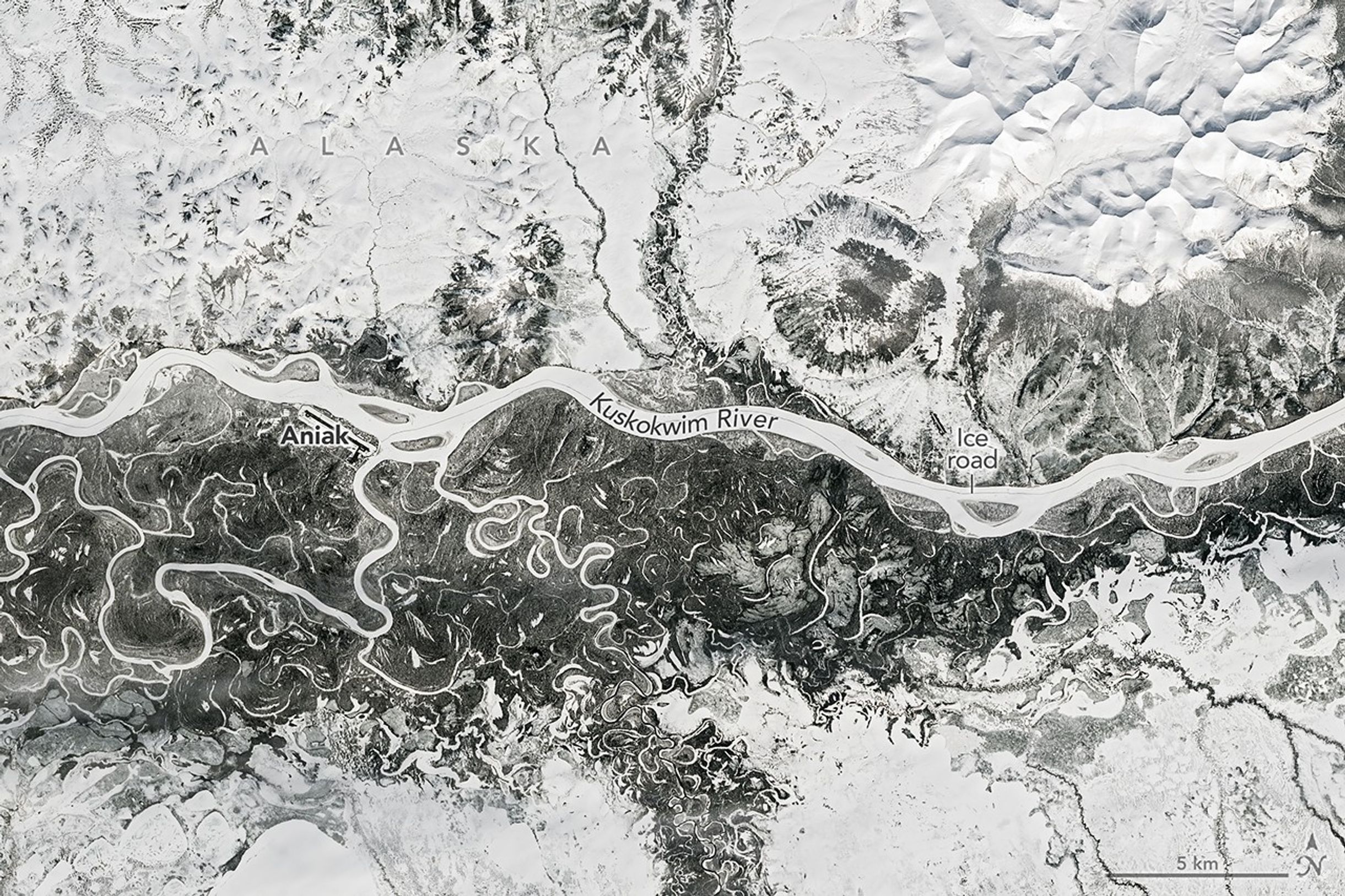
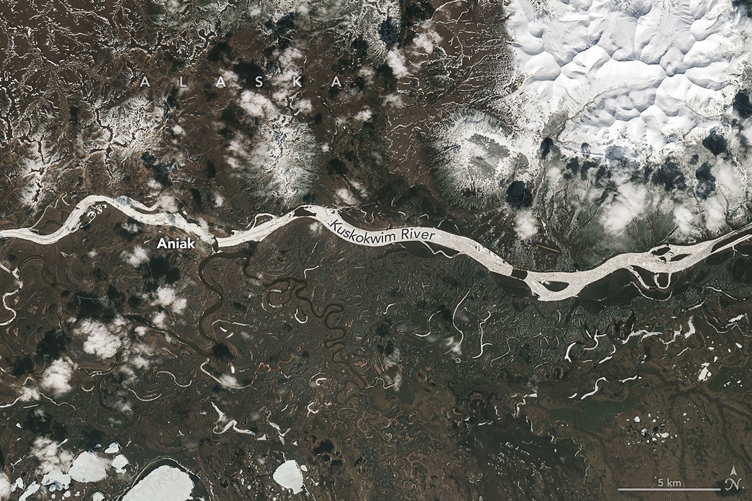
Image of the Day for May 14, 2026 Spring melt along Alaska’s Kuskokwim River caused ice jams and flooding. May 14, 2026 View more Images of the Day: Thawing may be a welcome sight for Alaskans following a remarkably cold winter and early spring in much of the state. But with melting comes the threat of rapid flooding in low-lying areas as river ice breaks up and periodically jams. The landscape along the Kuskokwim River appeared frozen in a Landsat 9 image acquired on April 21, 2026 (left). According to observations published by the Alaska-Pacific River Forecast Center , river ice near the town of Aniak was thick and still covered in deep snow as of April 16. The Kuskokwim ice road connecting numerous villages traces a dark line down the river. The thick river ice supported a route that extended about 350 miles (560 kilometers) in winter 2025-2026 and shut down for the season on April 10, according to news reports . Conditions were changing quickly around May 7, when the right image was acquired.…