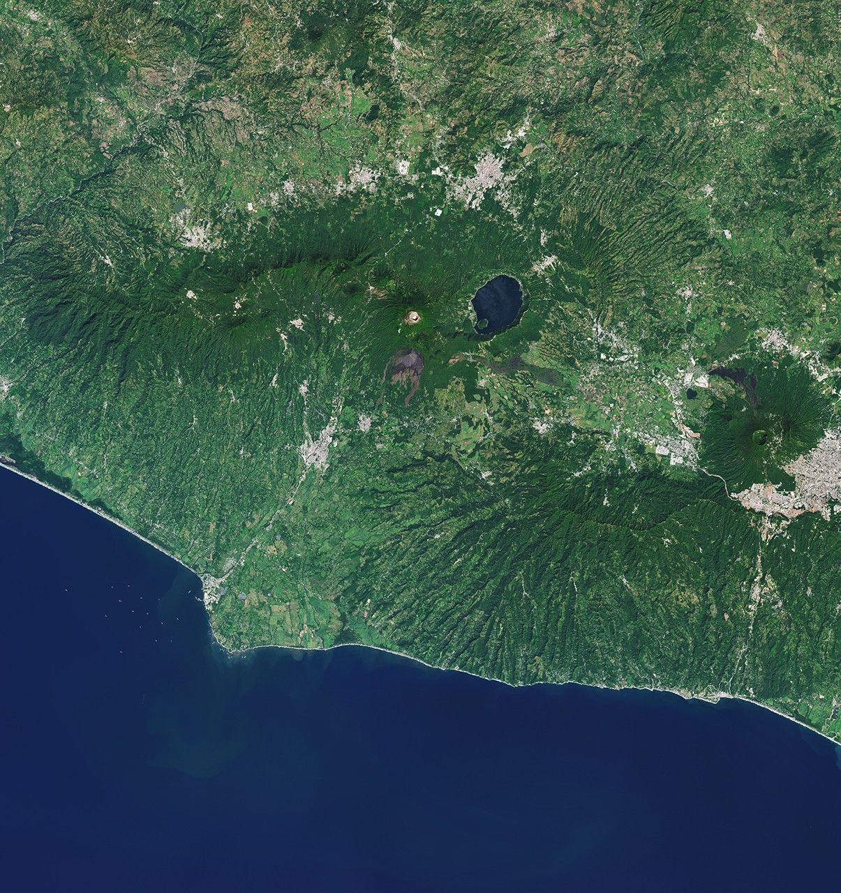
Image of the Day for May 5, 2026 From a geothermal hotspot to the one-time “Lighthouse of the Pacific,” the heat is on beneath the volcanic landscape of western El Salvador. May 05, 2026 View more Images of the Day: Volcanic activity takes on many forms in western El Salvador. The land near the city of Ahuachapán is pockmarked with craters and covered with recent lava flows. Meanwhile, a geothermal field feeds geysers, heats mineral pools , and powers a long-operating energy plant. The area is part of a volcanic landscape that stretches more than 1,000 kilometers (600 miles) along the Pacific coast from Guatemala to Panama, composing the Central American Volcanic Arc . On the right side of the image, Santa Ana stands at 2,381 meters (7,812 feet) above sea level as the country’s tallest volcano. Its summit features several crescent-shaped ridges surrounding a hot, acidic crater lake . The volcano remains active, with small to moderate explosive eruptions recorded since the 16th century.…