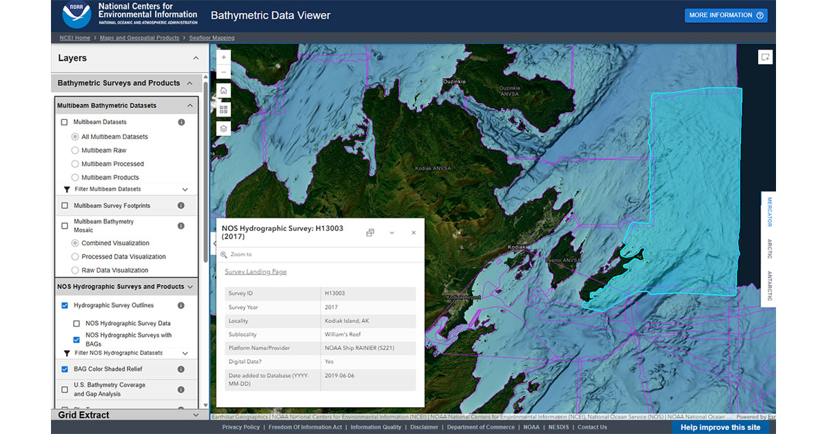
Screenshot of the NCEI Bathymetric Data Viewer, showing NOAA/NOS hydrographic survey data near Kodiak, Alaska. (Image credit: NCEI) What is Bathymetric Data? Bathymetric data is the mapping of underwater terrain and measurement of water depth, and is essential information for scientists in a wide range of fields. Bathymetric data is used to create nautical charts, which are crucial to large ships and maritime transportation, so they are aware of water depth and potential underwater hazards. This data also aids in the study of changing coastline erosion, and even helps scientists study bottom-dwelling organisms and how they live, feed, and breed. By updating the Bathymetric Data Map Viewer, NCEI is providing better access to the most accurate, up-to-date bathymetric data for scientists around the world.…