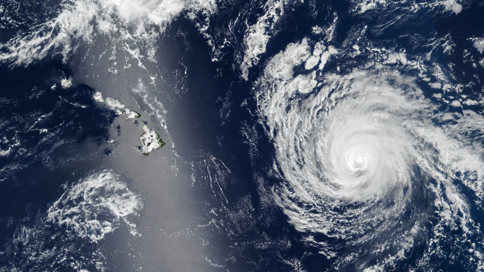
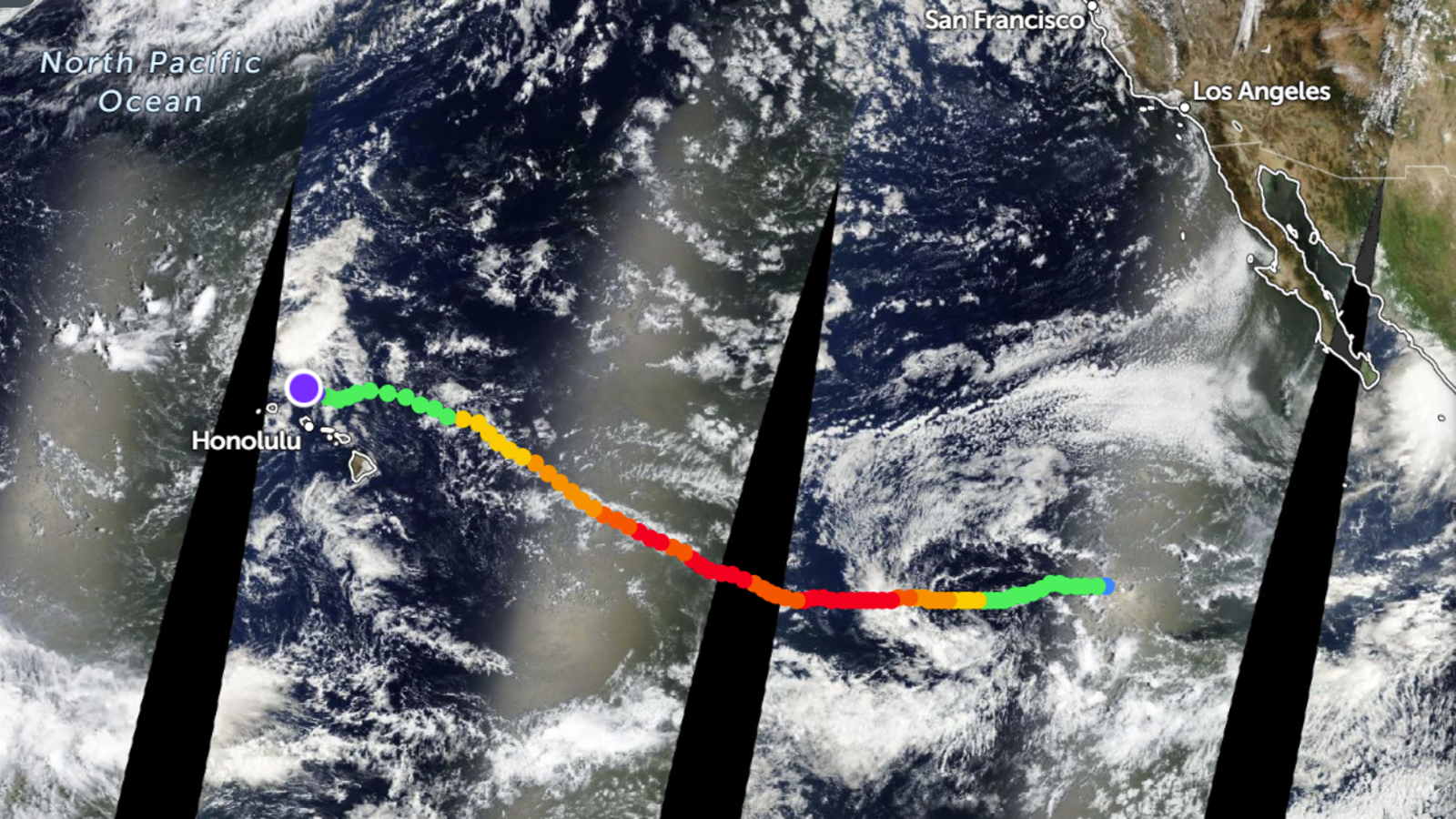
QUICK FACTS Where is it? Hawaii, North Pacific Ocean What's in the photo? A sunglint covers Hawaii as a hurricane barrels toward the islands Which satellite took the photo? Suomi NPP When was it taken? Sept. 7, 2025 This striking satellite snap shows a powerful hurricane bearing down on Hawaii as a shimmering silver streak obscures the tropical islands from view. Luckily, the hurricane weakened to a Category 2 storm before reaching Hawaii and diverted to pass mostly north of the islands, before finally fading away on Sept. 10, just off the coast of Honolulu, according to Zoom Earth . These changes, which were brought about after the hurricane hit a patch of cold water, meant that residents experienced some heavy rainfall and high winds but were otherwise unaffected. The satellite photo was snapped Sept. 7, when Kiko was around 600 miles (965 kilometers) east of Hilo on Hawaii's Big Island, according to NASA's Earth Observatory .…