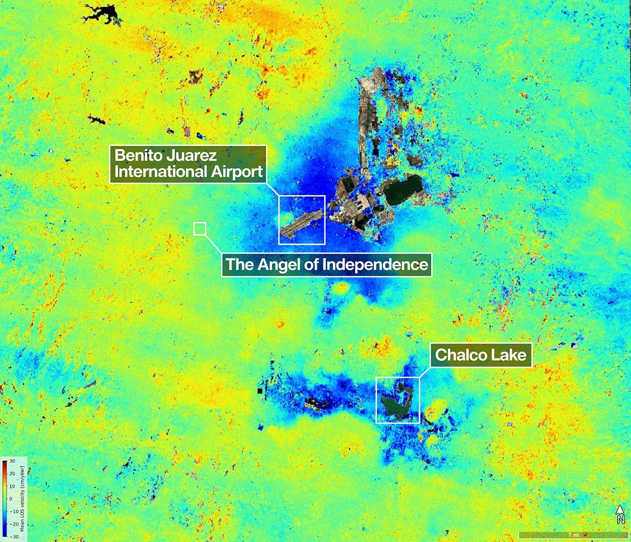
A scientist produced this map of land subsidence (sinking) in Mexico City using data from the NISAR (NASA-ISRO Synthetic Aperture Radar) mission captured between Oct. 25, 2025, and Jan. 17, 2026. The region has been a well-known hot spot of subsidence for decades, and images like this help confirm that NISAR is performing as expected in its first year of operation. The dark blue color indicates areas found to be subsiding by more than half an inch (more than 2 centimeters) per month, due in large part to groundwater pumping, which has led to compaction of the dry, ancient lakebed on which the city was built. The yellow and red areas are likely residual noise signals that are expected to decrease as NISAR collects more data and refines its measurements. Two marshy ecosystems with ties to the country’s past can be seen in the image. The dark green oblong to the northeast of the airport is Nabor Carrillo, an artificial lake constructed over the now-extinct Lake Texcoco.…