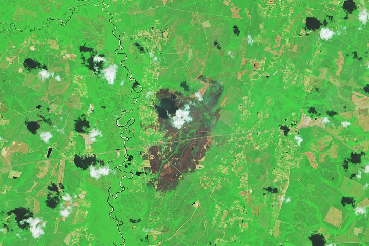
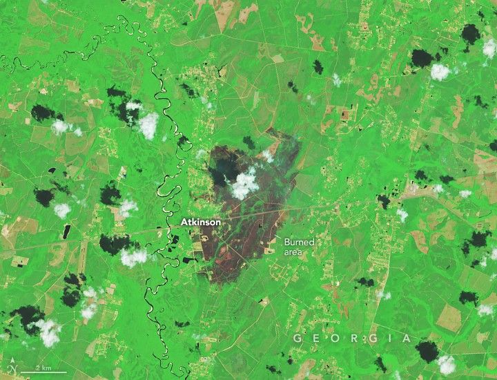
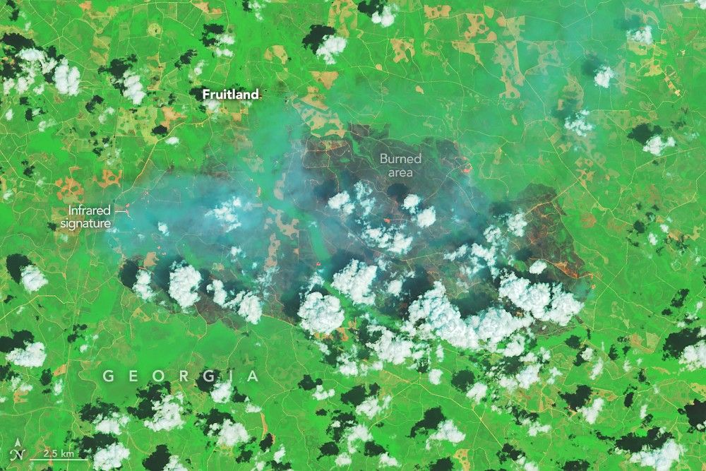
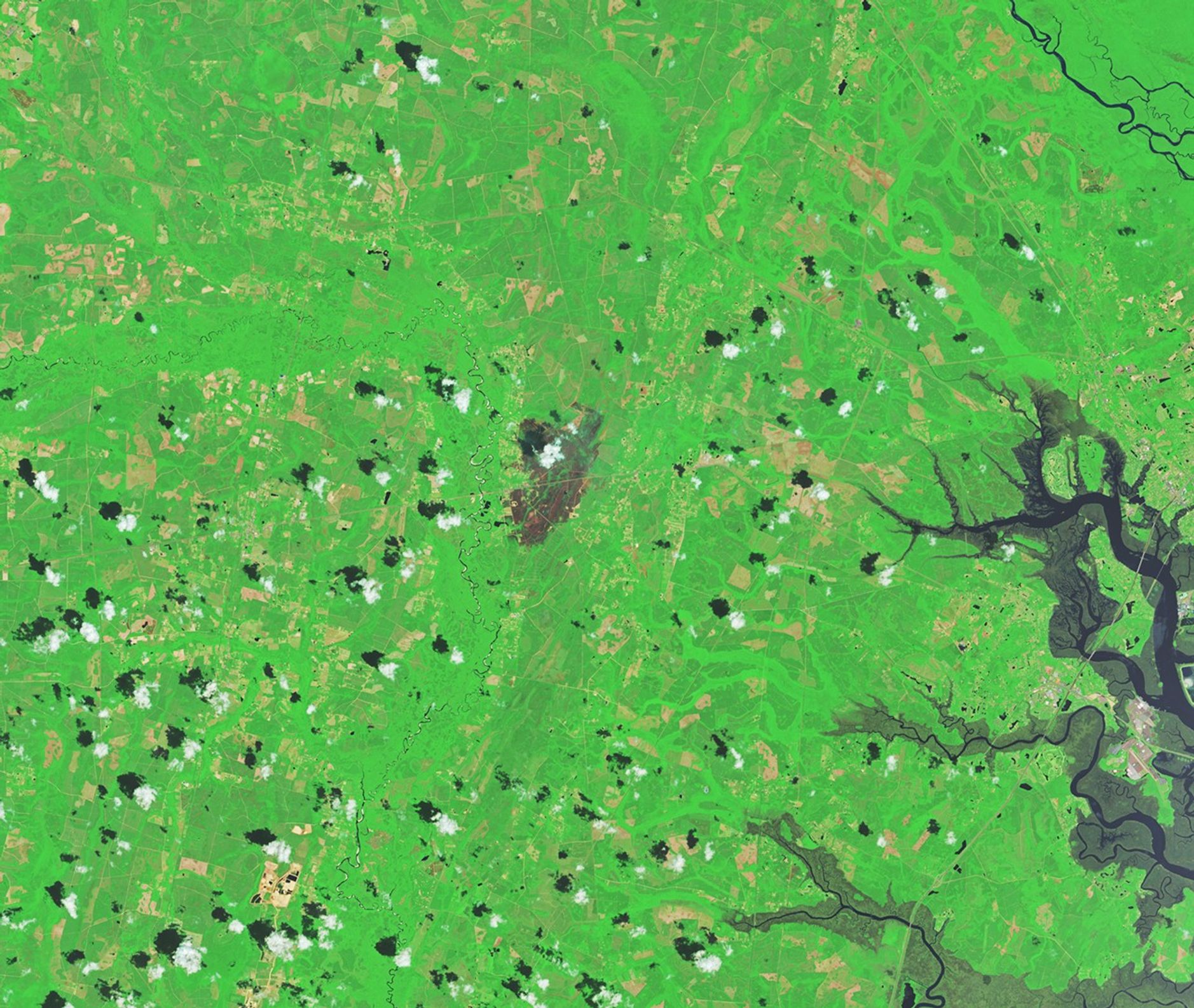
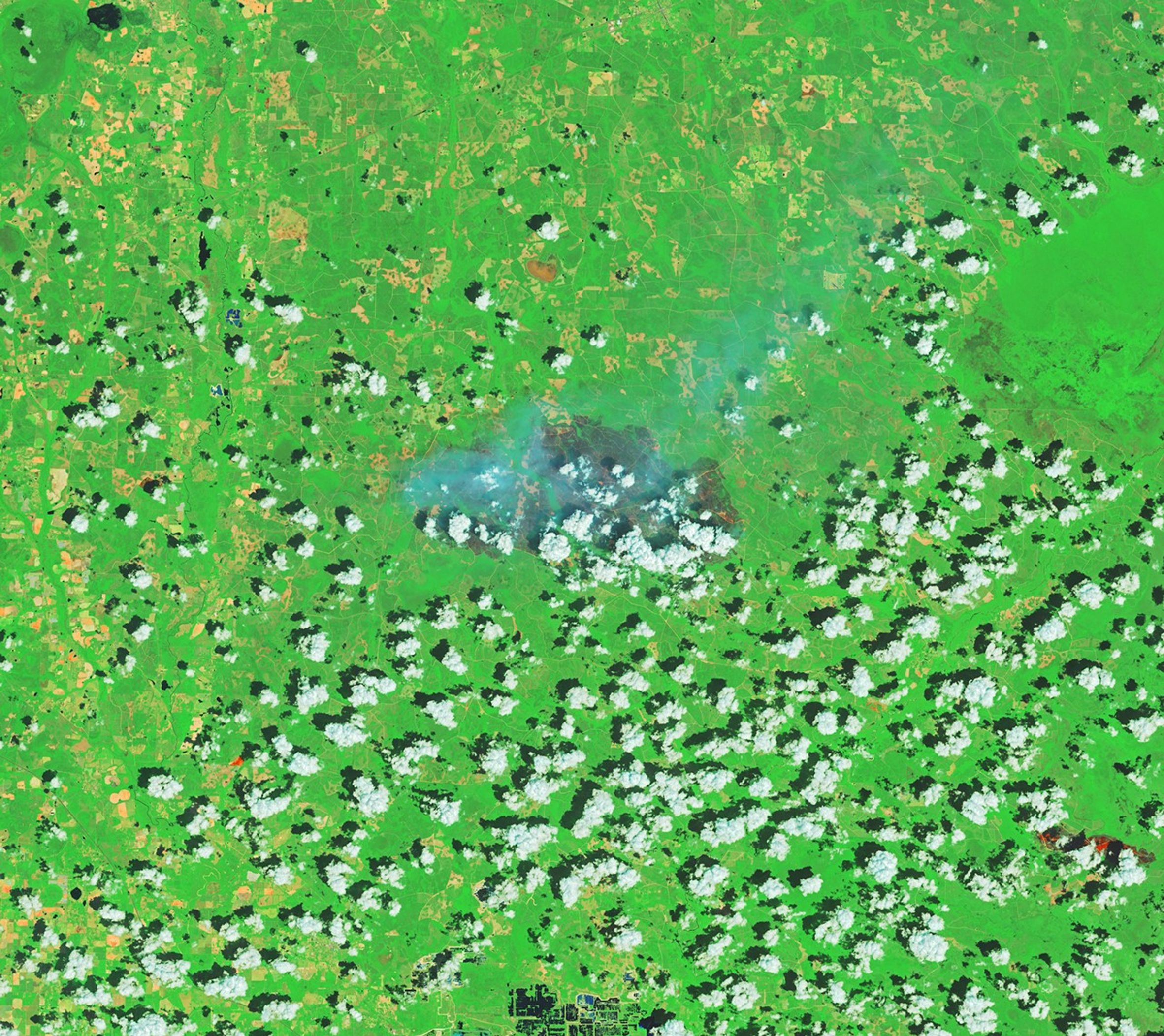
Image of the Day for April 29, 2026 Firefighters are battling two destructive blazes in the southern part of the state as drought grips the U.S. Southeast. Apr 29, 2026 View more Images of the Day: An extreme drought that has gripped the Southeast for months helped fuel two large, destructive, human-caused wildland fires in southern Georgia in April 2026. The Pineland Road and Highway 82 fires together burned more than 50,000 acres (20,000 hectares) as of April 28, according to the Georgia Forestry Commission . Satellite images of the fires captured by Landsat 8 show charred forests and residential areas in and around Atkinson (above) and Fruitland (below). The images are false color ( bands 7-5-4), in which burned areas appear gray and vegetated areas green. The infrared signatures of actively burning fire fronts are orange. By April 25, the fires had destroyed more than 120 homes—the most lost to wildfire in the state's history, according to news reports .…