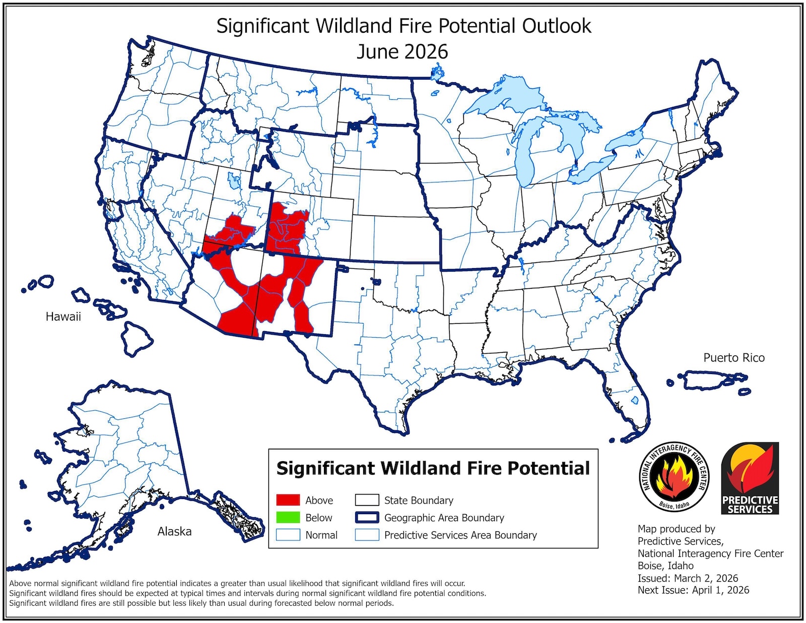
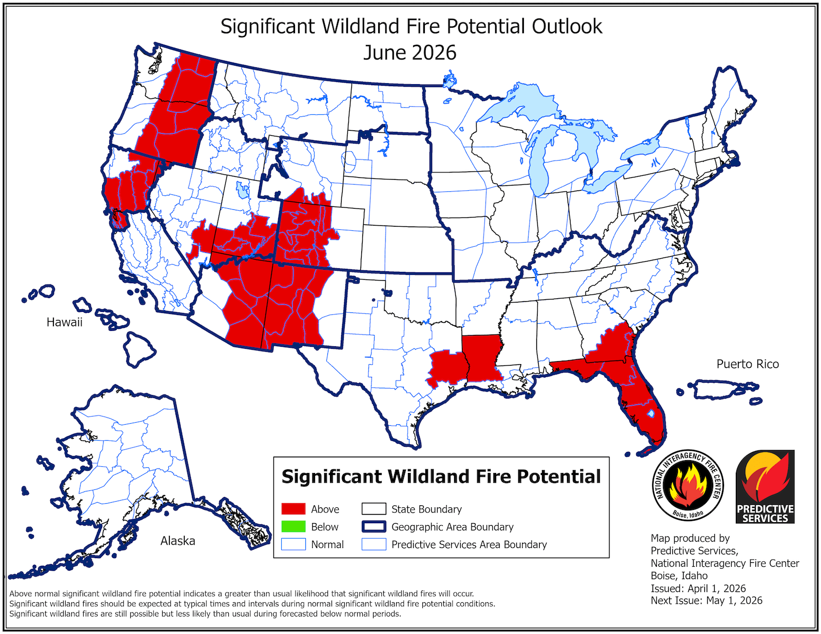
Every state in the West is expected to face an above-normal threat of wildfire this summer, according to the latest projections , released Wednesday by the National Interagency Coordination Center. The government-run center publishes monthly reports predicting fire risk for the four months ahead, and the change since the March outlook is staggering. The agency denotes elevated risk in red on its maps, and the June forecast from March 2 showed a small swath of rouge in the Southwest. But, citing an ongoing snow drought, rapid snowmelt, and a recent unprecedented heat wave, the latest maps feature red spilling across the Southwest and into the Rockies, Pacific Northwest, and northern California. “We’re probably not going to be in great shape this year,” said Matthew Hurteau, director of the Center for Fire Resilient Ecosystems and Society at the University of New Mexico.…